From Fiordland we drove to Invercargill, capital of the state of Southland, to purchase an international calling plan for our cellphone. We bought a 2degrees sim card when we arrived in New Zealand and the only 2degrees store on the south end of the South Island was in Invercargill. We found the store, bought an international plan with 300 minutes and headed to Oreti Beach Holiday Park 10 km (6 mi) west of the city.
 |
| Oreti Beach Holiday Park |
I needed international minutes to call my credit card company to report two suspicious charges. By the time I got through to them, they had already flagged the charges as questionable. When I told them the charges were fraudulent, they cancelled my account and said they would send me a new card. I explained that we were camping in New Zealand; they asked for the address. “We don’t have an address; we’re camping.” They asked where we would be in a week; I said I didn’t know. We needed the credit card because we didn’t carry a large amount of cash and they agreed to send the card to the hotel in Melbourne where we would be in two weeks.
 |
| Oreti Beach Holiday Park |
We paid the manager at Oreti Beach for a site and he directed
us to a gravel parking lot, but said we could look around if we didn’t like it. Caravans
were parked cheek by jowl on the lot, so I drove farther into the park. We
stopped to look at a vacant site on a dirt loop. A heavyset woman with red hair
wearing a long, red coat waved us on (as in keep on going). Too late; I was out
of the van looking at the site when she walked over. “This area is for the
permanent residents” she said – our first experience with segregation in a
holiday park – and suggested that we take the site with a concrete pad beyond a
red trailer. “It’s dry and has power.” I thanked her and drove away.
 |
| Oreti Beach Holiday Park |
 |
| Oreti Beach Holiday Park |
Most of the people in Oreti Beach Holiday Park are year-round residents. The online listing for the holiday park counted all the sites,
but did not clarify that only about 10 percent were available for transients like us. By 7
AM, the residents were up, fixing breakfast, showering and shaving and heading
off to work. They use the same communal kitchen and toilets/showers as the
transients, but they’ve improved their sites with landscaping, potted plants,
greenhouses and sundry lawn ornaments. Starting with a bare-bones trailer or bus,
they add an enclosed entryway, a storage shed, maybe a patio and some landscaping.
 |
| Feldwick Gates, Queens Park, Invercargill |
The next morning, we left the park and drove into
Invercargill to visit Queens Park. David, a Kiwi we had met in Australia, said
we shouldn't miss it. Invercargill is the largest city in Southland (48,000). It
sprawls over an open plain beside the Waihopai River estuary with low buildings spreading outward from the city center. Invercargill’s economy is
based on farming and, to a lesser extent, an aluminum smelter south of the city (link). Queens Park, which dates to 1857, occupies 80 hectares (200
acres) in the center of the city and includes a botanical garden (formal
planting began in the 1870s), golf course, cricket and lawn bowling clubs,
children’s playground and band rotunda (link).
 |
| Queens Park |
 |
| Queens Park |
We walked through the impressive black iron Feldwick Gates hung
on brick pillars and entered an English-style, formal garden. Walking down a
long, straight walkway lined by neat rows of trees, we left Invercargill
behind. There were sections devoted to roses, rhododendrons and azaleas; a
woodland and an alpine garden; and a Chinese friendship garden under
construction. We visited the aviary, which housed several native parrots,
including keas and kakas. It was sad to see them cooped up, but signs said that
the birds had been rescued and rehabilitated two decades earlier and couldn’t
be released into the wild. In a remote corner of the park, we found a small farmyard
with rabbits, guinea pigs, chickens and pigs commemorating its 19th century
agricultural heritage.
 |
| Greenhouse in Queens Park |
Leaving Queens Park, we headed south to Bluff, the southernmost
town, and one of the earliest European settlements, in New Zealand. Built around a large natural harbor at the
south end of the South Island, it’s the closest harbor to Australia, and the
main transshipment site for bauxite for the Manapouri Power Station in
Fiordland (link).
This area was settled by people from Polynesia about 1,000
years ago. It was the site of an early Māori settlement and a short-lived whaling
station in the 1830s (link).
 |
| Bluff Harbour from Bluff Hill (the island was man-made in 1960) |
 |
| Bluff Harbour |
From Bluff Hill, a 265-m (870-ft) lookout above the city, we
could see 50 km (30 mi) in every direction. Bluff Hill is an eroded, 235-million year old igneous
intrusion of magma from deep within the earth that formed on the edge of an
ancient supercontinent, Gondwanaland, when most of New Zealand was under the ocean
(interpretive sign). To the west was Waewae Bay and the mouth of the Waiau
River (link). To
the south, in Foveaux Strait, was Dog Island capped by a lighthouse, and
several small rock outcrops that barely qualified as islands, although they were
named.
 |
| Looking west from Bluff Hill toward the mountains of Fiordland |
 |
| Fishing boats in Bluff Harbour |
 |
| Fishing boats in Bluff Harbour |
Bluff Harbour is the departure points for most New Zealand
boats heading to Antarctica (link).
I walked the docks perusing the boats; most were workboats rigged for potting
crayfish (lobster). Bluff is known throughout New Zealand for its oysters, but
I couldn’t identify any boats rigged for dredging oysters.
 |
| Bluff Harbour pier |
 |
| Fishing for whitebait in Titiroa Stream |
From Bluff, we continued east on the Southern Scenic Tourist
Route (Hwy. 92) along Foveaux Strait crossing Titiroa Stream, which was lined
with whitebait stands (link). The landscape was dominated by sheep and green pastures surrounded by hedgerows planted
against the winds off the Southern
Ocean. We stopped at the information kiosk-cum-local history museum in
Waikawa. The woman behind the desk was a volunteer from Curio Bay. She told us that there was no petrol station in Waikawa and we would either have to backtrack 30 km (19 mi) to Tokanui or drive east 45 km (28 mi) to Papatowai. She asked where we were from, which prompted a story. For their honeymoon (40+ years
ago), she and her husband flew to the U.S., bought a car and drove south
through Mexico and Central America to Panama. They shipped their car to
Columbia and drove down the west coast of South America to Tierra del Fuego,
then up the east coast through Paraguay and back to the U.S.
 |
| Looking west from Curio Bay (vehicles in the campground at upper right) |
We stayed in the caravan park (link) at Curio Bay (link) on a bluff overlooking the Southern Ocean to the
south and Porpoise Bay to the north. The sites were separated by head-high hedgerows of flax to break the incessant
wind ("Roaring Forties"). We followed a 1-km (0.6-mi) trail down a cliff to the water to see a 160
million-year-old fossil forest, one of the largest and best-preserved coniferous forests from the middle Jurassic period (link).
 |
| Fossil forest at Curio Bay |
 |
| Fossilized tree trunks at low tide |
 |
| Stump of a fossilized tree at low tide |
Fossilized trees were visible halfway up the cliffs behind the beach, and
fossilized stumps and tree trunks decorated the rocky platform at low tide. Before
there were birds and flowering plants, Curio Bay was a floodplain surrounded by volcanoes; their eruptions buried the forest with ash and debris. During periods of high runoff, trees washed
down rivers to the floodplain where they were buried in volcanic ash and sediments. The
coniferous forest grew back only to be covered in sediments and debris during at
least four bouts of volcanism and floods over 20,000 years. The forest remained
buried for millions of years during which silica penetrated the wood and turned
it into stone. In the last 10,000 years, the sea has eroded the sedimentary rocks leaving the leaving the more erosion-resistant fossil trees visible at low tide (link).
 |
| Yellow-eyed penguin emerging from the water |
 |
| Yellow-eyed penguin walking up the shore |
The headlands are home to a colony of yellow-eyed penguins;
about 250 pairs nest in the dense stands of flax above the beach. The penguin
is native to New Zealand and one of the rarest penguins in the world (link).
We spent an hour on the rocky shore at sunset when the penguins return from feeding
at sea. We were told this was the best time to see them, but only one bird emerged from the water.
It waddled up onto the rocks and stood there for several minutes while 20+ people took its picture, then made its way up the shore, over the rocks and into the
vegetation. The Department of Conservation recommends 10 m (33 ft) as the safe
distance to view penguins, but no one seemed to heed it.
The smaller of the two walked down the hill for a short distance and
stood in the long grass. I went back to the caravan and brought Rande back to see the penguins. The larger one was standing on the trail in the sun
grooming itself. We did not get close enough to see the smaller penguin. After
a few minutes, it laid down on the trail and closed its eyes. We left it in peace.
 |
| Yellow-eyed penguins |
We had errands to do, including gassing the caravan and
dumping its holding tanks (the caravan park didn’t have a dump site, which was a
first for us). We planned to backtrack to Tokanui where we had seen a gas
station on our way to Curio Bay, but Val, the manager of the caravan park, said
that the gas station was closed from Saturday to Monday. She said there was gas at a
restaurant in Fortrose 43 km (27 mi) back toward Invercargill. She called to confirm that they had diesel. We would have filled up on the way to Curio
Bay, but believed, wrongly as it turned out, that small towns along the highway would have gas
stations. So we drove to Fortrose, found the gas pumps outside a restaurant and
waited in line with several other vehicles. Val said that
gas stations closed on weekends, and sometimes on Monday, because the south
coast was “remote.” I said that the West Coast was more remote and we always
found open gas stations, even on the weekends.
 |
| Fossil forest at Curio Bay |
Back in Curio Bay, I called the Dolma Hotel in Melbourne, our destination on our return to Australia, to see if I could have a letter
(with my new credit card) sent there. They said they would hold it for me. I called my credit card company and asked them to send it to the Dolma; they said it would be there in 4-6 days.
 |
| Paua fisherman |
Later that afternoon, Rande and I hiked around the headlands
to Porpoise Bay. We followed a trail through head-high flax that led down to
the rocky coast at the entrance to the bay. Large waves were crashing on the
rocks whipping the attached strands of brown algae back and forth in the foam.
An older man in a sleeveless wetsuit waded in a large pool sheltered from the
breaking waves. He was searching for paua (link),
New Zealand abalone, at low tide. Crawling among the boulders and reaching far
into crevices, he found them by feel and pried them off the rocks with a blunt pry bar. Rounding
the headland at the entrance to Porpoise Bay, we stumbled on a New Zealand fur seal
sleeping among the rocks.
 |
| New Zealand fur seal (female) |
Hector’s dolphins were surfing the waves in the bay. They’re
easily distinguished by their rounded dorsal fin and, at 1.5 m (5 ft), they’re one
of the smallest dolphins in the world and the only endemic cetacean in New Zealand (link).
Named for James Hector, the first director of the Museum of New Zealand, the
population of less than 7,000 makes them among the rarest of dolphins in the
world (link).
About 20 Hector’s dolphins live in Porpoise Bay in the summer. Department of
Conservation signs around the bay caution swimmers and surfers not to get too
close to the dolphins and interfere with their behavior. The dolphins were in and around the surf
all day, and so were swimmers and surfers. Everyone was thrilled to see them
riding the waves. Many pictures were taken.
 |
| Yellow-eyed penguin |
They were biologists from Yellowknife in the Northwest
Territory of Canada. He worked for the military
as a civilian on environmental issues; she worked for the federal government. I
talked about the fish research I had done in the Pacific Northwest. Put three
field biologists together and there’s lots to talk about. I told them we have
been traveling for three years mostly in Mexico. They
wanted to know if the country was as dangerous as they had heard. They were catching a boat to Stewart Island and we were heading east; we wished each other safe travels.
 |
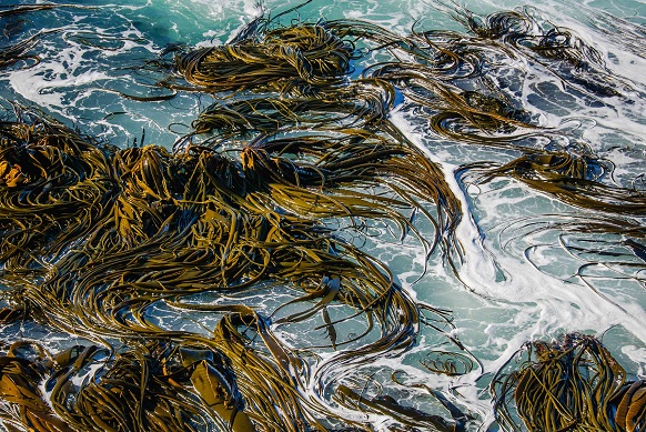
| Green algae cover the rock platform at low tide |
Overnight the weather turned cloudy and cold with winds from
the southeast. Curio Bay faces the Southern Ocean (next stop Antarctica) and suffers
cold fronts moving up from the south. Friday and Saturday were delightful. Locals swarmed the beach on Saturday for the warm weather. The surf school gave lessons in Porpoise Bay. Our plan was to continue around the south end of the South Island and be in
Dunedin in 2-3 days. Time to move on.
 |
| Catlins Forest Park |
We drove east on the Southern Scenic Tourist Route (Hwy. 92) through
Catlins Forest Park (link), but there were no pullouts or roads or trails into the
interior. I pulled over and hiked along the road taking pictures of the native
forest and sheep pastures and tree plantations hard against the forest. It was
sad to see that the native forest was still being cleared to create pastures
for sheep and plantations for the introduced Monterrey pine (link).
 |
| Sheep pasture adjacent to Catlins Forest Park |
 |
| Monterrey pine plantation adjacent to Catlins Forest Park |
We took the turnoff for McLean Falls, about 3 km (2 mi) north of Hwy. 92.
David, a Kiwi we had met in Australia, said we should see it. There were 20
cars in the parking lot when we arrived. It was an easy hike on a
well-maintained trail through a forest of native rimu pines (link), Māori-holly and tree
ferns into the Catlins Forest Park. We hiked to the base of the falls clambering carefully over the wet algae-covered rocks.
 |
| Trail to McLean Falls in Catlins Forest Park |
The falls were named for Alexander McLean, a well-liked farmer, who guided people to the falls in the early 20th century. A plaque near the trailhead described him as: "A well-rounded person, as farmer his sheep-shearing ability was specially acknowledged. Unmarried, his housework was also respectable, well known for baking his own bread and churning his own butter."
 |
| Tautuku River below McLean Falls |
From the base of the 22-m (72-ft) high upper falls, I thought I saw a route up the
hill to, I assumed, a trail back to the carpark. Wrong. The trail climbed
almost vertically up tree roots and over rocks to the top of
the falls, but it was steep and muddy and I turned back before reaching the top.
Now I had to down-climb the slippery mess that I had just carefully negotiated.
 |
| Lower McLean Falls |
On the very last step at the base of the upper falls, I
slipped and took a nasty fall. I laid
there for a few seconds trying to gather myself; nothing broken, but I was bruised and
covered with mud from the waist down. A young Asian couple rushed over to see
if I was alright. How embarrassing. I
said I was okay and hobbled away down the trail where I ran into Rande. She saw that I
was covered with mud and asked what happened. We walked back to the carpark, more slowly than my normal pace, and had lunch in the caravan.
 |
| Upper McLean Falls |
Retracing our route back to Hwy. 92, we continued east and stopped at Florence Hill overlooking Tautuku Bay on the east side of Catlins Forest Park. An interpretive sign at the overlook proclaimed that: "It is the only place left on the east coast of the South Island where native forest fully covers a catchment from hill-tops to sea" where "Ancient forest with trees over 1000 years old, grow right down to the seashore." I guess it's something to be proud of, but I think the sign writer missed the irony: most of the original forest had been cleared for sheep, cattle and tree plantations.
 |
| Catlins Forest Park and Tautuku Bay from Florence Hill |
After Florence Hill, Hwy. 92 turned inland passing through
Owake, a small town with a gas station and grocery store. We found three
caravan parks on a side road south to Pounawea. We looked at the two on the west side
of the estuary (Catlins Lake): one was crowded with large trailers that catered to permanent residents. The other park was an unappealing
grass field outlined with caravans backed by a fence. Rande inspected the
amenities; she wanted something less primitive than Curio Bay (where she
wouldn’t take a shower in a converted concrete water tank capped with a tin
roof).
 |
| Catlins Lake at Pounawea |
Neither park met her criteria. We drove to Newhaven Holiday Park (link) on the other side of
the estuary, which turned out to be smaller (eight powered sites) and in a more agreeable location. It had a laundry (we were almost out of clean, warm clothes) and
bathroom with a hair dryer (for her). We were the only caravan, so we took the
best site overlooking the estuary. I went out to walk the beach while Rande
watched the sun set over the mountains from the comfort of the caravan.
 |
| Catlins Lake at sunset |
The next morning was gray and raining with low clouds and
low contrast lighting. We left Pounawea about 10:00 AM, a late start for us, and
continued northeast on the Southern Scenic Tourist Route through Balcultha and
Milton to Dunedin, the largest city in Otago. Sheep and cattle pastures give
way to agricultural crops. We saw farmers baling hay, clusters of grain silos
along the road and farm machinery dealers lined roads in the towns. The low-lying hills
were capped with managed forests – monocultures of dark-green, uniform-sized pine
trees sitting like ill-fitting caps on the shoulders of so many pastures.
 |
| Our caravan at Oreti Beach Holiday Park near Invercargill |
Before we left New Zealand, I called the Dolma Hotel to see if they
had received a letter addressed to me; they hadn’t. So I called the credit card company again
and was told that they sent it to our U.S. address. I asked why it wasn’t sent
to Melbourne – because the hotel’s address had been entered in the “notes” field,
not in the "address" field. They cancelled that card and sent another one to
Melbourne, which was there when we arrived. I’ve had that account number since 1993 without any fraudulent charges. That’s the good news. The bad news is that it’s a pain in the butt to have a card canceled and get a new one 8,000 miles from home.


No comments:
Post a Comment