After leaving Washington, we headed for the Coastal Bend of Texas for the rest of the winter. I had been to Corpus Christi a couple
times on business and the area looked interesting. The northern Gulf of
Mexico is well-known for recreational fishing and the coastal marshes and
woodlands are birding meccas. We were ready to leave the cold and wet Pacific Northwest. We rented a house in Rockport, about a
half-hour east of Corpus (as the locals refer to it), and became honorary
“winter Texans” (the Texas equivalent of "snowbirds" of the Southwest). Here’s the first of a couple posts on the interesting things
we learned in this corner of the Lone Star State.
 |
| Small (coppice) dune on the beach at Padre Island National Seashore |
 |
| Beachcombers at Padre Island |
 |
| Rande beachcombing at Padre Island National Seashore |
 |
| Seabeans |
Seabeans, also known as drift seeds, are produced by
flowering trees and vines in tropical forests where floating in water is a
dispersal mechanism. Seeds and nuts that fall into waterways can be carried to
the ocean and dispersed by ocean currents. Most of the seabeans found on Padre
Island come from the Caribbean and Central and South America (link).
Beachcombing for seabeans is a serious hobby (link).
There are websites and blogs devoted to seabeans (link); seabean guidebooks (link);
polished seabeans (link) and seabean jewelry (link). And there’s an Annual International Sea-Bean Symposium and
Beachcombers’ Festival. The 21st annual festival will take place in
Galveston, Texas, October 14-15, 2016 (link).
 |
| Rande's collection of seabeans from Padre Island |
Wind is the primary driver of geologic processes on Padre
Island and it usually blows from the southeast between 7 and 30 miles per hour. It drives
the currents that bring shells, seabeans (drift seeds), driftwood and trash to
the island. Wind-blown sand creates the beaches and dunes, and covers paved
roads and parking lots. Blowing sand is a “good thing” to park managers; it
makes more work for them, but it keeps the island from eroding away. Barrier
islands like Padre reduce impacts on the mainland of high winds and waves generated
by tropical storms and hurricanes (link).
 |
| Drift log on the beach |
The landforms of barrier islands are classified based on
location and the processes that create them (link; (link). Let’s hike across Padre Island from the Gulf of Mexico to Laguna
Madre beginning at the beach. The swash runs up the forebeach after an incoming wave has broken (link);
this is where shells accumulate. The backbeach
is where trash and debris are deposited by high tides and storms.
Wind-blown sand creates small dunes around vegetation on the
backbeach known as coppice dunes;
they’re generally less than three feet high. Rande found most of the seabeans in the wrack line (line of organic debris and trash stranded by the tides) on the backbeach among the coppice dunes.
 |
| Willets feeding on the forebeach |
 |
| Trash among the coppice dunes on the backbeach |
 |
| Ghost crab on a coppice dune |
From there we climb the foredune
ridge, which in most areas is covered with vegetation, and can be up to 50
feet high and 200-300 feet wide. The foredunes parallel the shoreline and
protect rest of the barrier island from the full force of tropical storms.
 |
| Foredune ridge |
 |
| Dew-covered spider webs on foredune grasses... |
 |
| ...and the spider that spins them |
Behind the foredunes are the stabilized dunes up to 20 feet high. These elongated and curved dunes
were once part of the foredune ridge, but were blown out by storms and migrated
inland where they were overgrown with vegetation and stabilized.
 |
| Stabilized dunes |
 |
| Javelina foraging among the stabilized dunes |
 |
| Prickly pear cactus and Indian blanket in the stabilized dunes |
Beyond the dunes are the barrier
flats, the most extensive landform of the island and generally less than
five feet above sea level. The barrier flats (also called the coastal plain) were at one time sand flats; the
more sparsely vegetated flats are where grasses have recently become
established. Cattle grazed the barrier flats during the ranching era.
 |
| Barrier flats beyond the stabilized dunes |
 |
| Barrier flats |
Freshwater and brackish ponds
and wetlands occur in troughs and depressions on the barrier flats. The
ponds hold water because mud, plant debris and wind-blown sand seal the bottom.
Ponds and wetlands are important habitats and sources of freshwater for the
island’s wildlife.
 |
| Freshwater pond on the barrier flats |
 |
| Blue-winged teal and pintail take flight and two American coots and a ruddy duck on the pond |
Across the barrier flats are back island dunes, low dunes that can range from barren to vegetation-covered.
The blow-out dunes and sand flats are the sources of sand for the back island
dunes.
 |
| Back island dunes |
 |
| Tidal marsh on Laguna Madre |
 |
| Laguna Madre shoreline with accumulating seagrass debris |
Laguna Madre is the largest hypersaline (1.5 to 3 times saltier
than seawater; link) estuary in the world. It’s 277 miles long,
4-6 miles wide (10 miles at its widest) and averages less than four feet deep. The
lagoon has no freshwater river inputs and is largely isolated from the Gulf of
Mexico by Padre Island. It formed about 3,000 years ago with the stabilization
of the Texas coast and creation of Padre Island (link).
High salinity results from high evaporation rates, lack of freshwater inflows
and low inputs of seawater from the Gulf of Mexico (link). High
winds can push lagoon waters to one side of the bay for several days leaving
behind shallow pools that evaporate in the intense Texas heat. When the winds
die, the water moves back to the other side, filling the dry pools and
dissolving the salt crystals increasing the salinity.
 |
| White and brown pelicans share a small island in Laguna Madre |
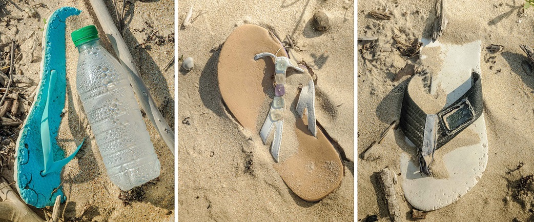
The winds, currents and tides of the Gulf of Mexico bring
trash, shells, seabeans and driftwood to Padre Island from as far away as South
America. The amount of trash on the beaches is directly related to the
strength, direction and duration of the wind; the height of incoming tides; and
the amount of trash dumped into the Gulf of Mexico. Winds and tides move trash
across the beach where it can be buried by wind-blown sand. Subsequent storms
and high tides can uncover and move the trash down the beach back into the Gulf
of Mexico (link). In a long-term study of trash on Padre Island
beaches, the park identified the following major sources: Mississippi River,
storms, commercial shrimping industry, offshore oil and gas industry and Mexico (link).
 |
| Novillo line camp, the last standing remains of the Dunn family cattle operation |
Padre Island (Spanish for Father Island) was named for Padre
Nicolas Ballí, a Spanish priest and the first permanent settler in 1804. Ballí
introduced cattle to the island, and for three decades he and his nephew used
the island for grazing. At the end of the United States–Mexican War (1848),
Americans replaced Mexicans as island ranchers; by the Civil War, the island
supported a small community of cattle ranchers. In 1876, Patrick Dunn, an
Irishman, moved to Padre Island, developed a large cattle ranch and ultimately
acquired most of the land. The Dunn family enterprise continued until 1971 when
the Park Service removed cattle from the island (link).
 |
| Corral at the Novillo line camp |
The early settlers of Padre Island did not have milled
lumber, so they scavenged driftwood, metal objects and ropes from the beaches
to build huts, kitchens, fences, corrals and furniture (link). “The [backbeach] is the site of
a very large accumulation of flotsam and jetsam…Many of the bottles, boards,
trees, shoes, rope, coconuts, and other things that make Padre a beachcomber's
paradise have washed ashore after they drift hundreds or thousands of miles
across the ocean” (link). The park encourages
beachcombing and allows visitors to remove up to five gallons per person per
day (link).
The drifting seeds from South America got Rande’s attention and they were the focus
of her beachcombing trips, but first, the oceanography that brings them there.
 |
| Polypropylene lines and railroad vine |
Warm water from the Caribbean Sea flows between the Yucatan
Peninsula and Cuba (Yucatan Current) into the Gulf of Mexico. The current flows
north before looping east (Loop Current) and exiting the Gulf of Mexico south
of the Florida Keys (Florida Current) to become the Gulf Stream in the Atlantic
Ocean. The Loop Current can extend as far north as the delta of the Mississippi
River, forming a large loop. To return to its direct configuration, a loop pinches
off as a clockwise-rotating, warm-core ring, which traps floating debris carrying
it west-southwest toward Texas and Mexico (link). Nearshore currents in the northern Gulf of Mexico flow west along the coast from
Louisiana toward Texas. Nearshore currents off Mexico flow north along the
coast toward Texas. The currents converge at about 27 degrees north latitude
(Padre Island). Floating objects are brought ashore by winds, waves and tides where
the currents converge (link).
 |
| Fishing lures |
The beaches of Padre Island are fine quartz sand with lesser
amounts of minerals, rock fragments, shells and shell fragments. The highest
concentration of shells occurs where the longshore currents from the east and
the south converge and waves concentrate sand and shells on the beach. Eventually
the finer sand is blown landward leaving large shell-fragment deposits. The
park map identifies Little Shell Beach (mile 10-15 from the end of the paved
road) and Big Shell Beach (mile 20 to 27). Little Shell Beach is dominated by
shells from Donax, a small surf clam.
Big Shell Beach is dominated by shell fragments of quahogs and large clams. The
shells have been significantly abraded by wave action (link; (link).
 |
| Big Shell Beach |
 |
| Tire tracks on Big Shell Beach |
 |
| Big Shell Beach details |
According to the park service, “Driving on the beach is an incredible adventure, but it
takes experience and preparation.” The handout, entitled Traveling Down Island, warns that access by two-wheel is limited to
the first five miles, that it costs hundreds to thousands of dollars to for a
private wrecker to tow you out if you get stuck (“The National Park Service
does not tow vehicles…”) and that driving into vegetated areas is prohibited. Beach-driving
is allowed at other national seashores and state and local beaches around the
country (link),
but it’s not without its problems. It widens beaches, inhibits sand accretion
and narrows the barrier island, increases beach erosion and instability during
storms, and reduces the natural dune-rebuilding capacity between storms (link).
 |
| Driving on the beach at Padre Island |
One day, Rande and I were at Big Shell Beach, about mile 26;
I was hiking in the dunes and she was beachcombing when she found a small glass
bottle with a pink, rolled-up paper inside. There was no cork and, while the paper
was laminated, it showed signs of water damage. The message on the long, narrow
paper was a poem written to “Poetry Girl” signed by “Alamo” with a phone number
and the date (September 2015) next to the name. Did the message float down a river
to the Gulf of Mexico? Was it carried by currents and waves to Padre Island?
 |
| Alamo's bottle and message to Poetry Girl |
Rande shared the poem with several of her new friends, including
the staff of the park visitor center. The women thought it was romantic and
wanted to know more. Three men read the poem; one said “look what you
started!”; one said Alamo should move on with his life; and one, an older
volunteer at Padre Island National Seashore, said that he was going to put a message with his phone
number in a bottle and throw it in the ocean for Rande to find so she would
call him.
Could she miss
the love letters
that I tear up
and throw away?
A week later, Rande called the phone number in Arkansas and
left a message on the answering machine that she had found a bottle on the
beach at Padre Island with the message to Poetry Girl from Alamo and asked her
to call if she wanted to know more.
She broadcasts
her seeds in my
soul and waters
them oh so well.
A week later, Poetry Girl called Rande and began to reveal
the story of Alamo. Poetry Girl lives in Arkansas and dated Alamo, who lives in
San Antonio, in high school, after which they went their separate ways, married
other people and raised families. Rande sent her the poem and some seabeans and
sea glass she found nearby.
I can never lose
hope as
my flame still
burns brightly for
her…
Poetry Girl shared Rande’s emails with Alamo, who then added
to the story in emails to Rande. Poetry Girl was his muse. Over the years they've exchanged
poems and emails. Every year when Alamo goes duck hunting in Aransas Bay north
of Corpus Christi, he walks across the Matagorda Island and throws a bottle
with a poem to Poetry Girl into the Gulf of Mexico. He hopes that it will be
blown offshore and carried east by currents, maybe into the Atlantic Ocean. The
bottle that Rande found traveled about 70 miles in a straight line. It was the first time the finder contacted Poetry Girl.
 |
| Picnic table near the visitor center at Padre Island National Seashore |
It’s not unusual to find a message in a bottle on Coastal
Bend beaches. Tony Amos, a researcher at the University of Texas Marine Science
Institute in Port Aransas, has found more than 100 messages in bottles,
including two thrown overboard from the same ship more than a year apart. The
first one traveled 438 days and 3,500 miles; the second one traveled 530 days
and 4,000 miles; both ended up on Mustang Island, a barrier island north of
Padre Island. The 74-year old Amos estimated that he’s traveled 16,000 miles up
and down the island over the years – that’s one message every 160 miles;
clearly you have to work to find them (link).
You can read more message-in-a-bottle stories here (link) and
beachcombing stories, including the saga of yellow rubber duckies lost off a
ship in the Pacific Ocean, here (link).

A word about climate change. Barrier islands are the first
line of mainland defense against coastal storms and hurricanes. As ocean water warms
it expands causing sea levels to rise (thermal expansion), and the extra heat is
fuel for more intense storms. If (when?) the ice sheets of Antarctica and
Greenland melt, sea levels will rise more and faster.
Since 1958, relative sea level at South Padre Island has
risen 0.14 inches per year. Relative sea level includes changes in worldwide
sea level (eustatic) plus changes due to land adjustments (tectonic). Sea level
rise in south Texas is consistent with the worldwide eustatic rate of 0.12 inches
per year (link). The Geological Survey estimated that 45% of Padre
Island National Seashore is highly vulnerable to sea level rise, which means it
is more susceptible to shoreline erosion (land loss), saltwater intrusion into
freshwater aquifers and inundation of freshwater wetlands and estuaries.
Twenty-six percent of the national seashore’s beaches has low vulnerability to
sea level rise (link).

The Texas Bureau of Economic Geology estimated that 80% of
Texas beaches on the Gulf of Mexico retreated between 1930 and 2012 (based on
areal and ground surveys). The average rate of shoreline retreat was 4.1 feet
per year, or 178 acres per year. From 1920 to 2012, average retreat was 2.7 feet
per year at North Padre Island (3.7 feet per year from 2000 to 2012) and 7.5 feet
per year at South Padre Island (5.2 feet per year from 2000 to 2012) (link). With higher sea level and storm surges, sand dunes and wetlands will migrate
inland and park managers will have to decide whether to move buildings, roads
and parking lots farther inland (retreat); protect infrastructure with barriers
(adapt) (link); or abandon the barrier island.

Santa Fe,
ReplyDeleteThank you for posting a little portion from my ocean blog in your online blog.
Alamo
I loved the story of Alamo and Poetry Girl! I also found the sea beans to be fascinating. Jeff, you seriously need to be a professional travel writer. I read every word.
ReplyDelete